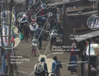
In this thesis, Ese offers a critique of historical and current mapping efforts used to describe and analyse popular settlements in Nairobi. At the same time, he provides alternative ways to approach mapping in such contexts useful to both planning and architecture.
From a review of mapping practices from the 1910s until today, it is argued that both current and historical mapping efforts in popular settlements are closely linked to the policies and zeitgeist of their periods, and that mapping efforts have help underpin existing attitudes towards settlements as much as challenge them. The historical review of mapping efforts indicates that, save a few exceptions, they tend to overemphasise the homogeneity of popular settlements. By providing a historical mapping of Pumwani, a popular settlement in Nairobi, a different picture is provided, highlighting social, cultural, and economic diversity. Evidence is provided that such popular settlements should not be limited to being described as only neighbourhoods for the poor.
Based on the premise that many mapping efforts fail to uncover this diversity, an alternative mapping method is provided that relies on historical data and social analysis. Synthesising theory, data collection, interviews, historical and present-day research, the mapping method seeks to better highlight the current socio-economic diversity of Pumwani and its connections to spatial practices. Such diversity and connections are important to uncover for planners and architects seeking to do interventions in popular settlements.

