The Art of Svalbard, May 23-June 1, 2015 » Blog-88-Image-5
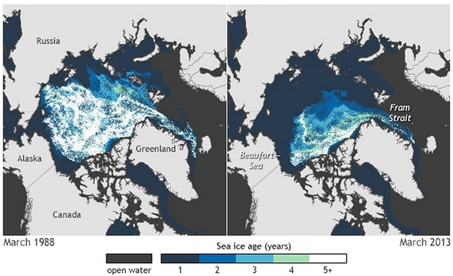
Map of Arctic sea ice thickness and extent, March 1988 vs. March 2013. Svalbard is the star-shaped land halfway between the coast of Norway in the upper right and Greenland. Image courtesy of the NOAA Climate.gov team, based on data provided by Mark Tschudi, University of Colorado.
Map of Arctic sea ice thickness and extent, March 1988 vs. March 2013. Svalbard is the star-shaped land halfway between the coast of Norway in the upper right and Greenland. Image courtesy of the NOAA Climate.gov team, based on data provided by Mark Tschudi, University of Colorado.